I test hiking apps by, well, hiking. I use them to find, build and navigate trails and backcountry terrain.
Although I’m not a professional mountain guide or extreme hiker, I’ve been hiking regularly for more than a decade and would consider myself advanced. I hike multiple times a week and have summited a handful of challenging peaks, including Mount Whitney, Half Dome and Costa Rica’s Cerro Chirripó, as well as many other notable hikes around the Sierra Nevada mountains where I live. I enjoy hiking in national and state parks across the US and exploring trails while traveling internationally.
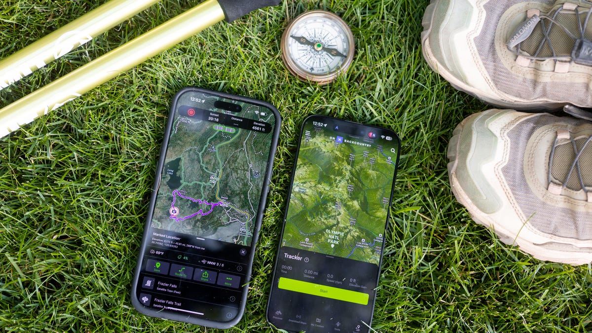
AllTrails has been my primary source for locating and navigating hikes until recently. I’ve exhausted most of the known trails around our area and sought a new app to help me plan and execute more backcountry hikes.
I’ve tested seven other hiking apps for the past month to compare and contrast features and functionality. The main qualities I considered when selecting the apps on this list include functionality and features, user interface, trail database, offline maps, navigation, pricing and reviews.
User interface: I’ve familiarized myself with each app’s interface, learning its features and functionalities. I note whether it’s pretty intuitive and easy to pick up or if there’s a significant learning curve. Once I have a trail picked or a custom route created, I’ve been hitting the trails and using the apps to navigate, paying attention to how accurately the GPS tracks my movements, how easy it is to follow the trail and how the maps display on my phone.
While testing the popular (and free) Hiking Project app, I had issues with the interface and functionality, including glitches, app crashes and the inability to zoom in or out, which is part of the reason it didn’t make the list.
On each hike, I use two apps to compare and contrast their functions. I note whether they have glitches or issues with rotating the screen and zooming in or out, as well as which maps are most accurate compared with the actual paths, landmarks and general topography in front of me.
Offline navigation: One of the most critical components I looked at is access to maps and navigation offline. After all, it doesn’t matter what app you use if it won’t work when you lose cell service. Luckily, these offline features are becoming industry standard, and most outdoor hiking apps now offer them — though they’ll make you pay for it. I always download the trail and maps I need before heading out (I’ve been burned by not doing that in the past).
Features: I examine the app’s other features, including extra overlays, weather forecasts, satellite previews, safety tools and community features, such as whether there are user-generated reviews and photos. Finally, I look at the posthike interface and assess how accurately the app measured all my metrics during the hike.
I asked the experts
Anouk Erni of Blackbird Mountain Guides, a highly experienced, certified mountain guide with an impressive list of credentials longer than the alphabet, offered expert insight.
“Many guides and recreationalists use either CalTopo or Gaia for planning routes and downloading maps with different topographical layers. These apps work very well for trip planning and allow you to incorporate layers such as snow coverage, global imagery, US Forest Service maps and topo and contour lines. If you’re into creating routes on your map, these have many features, such as creating geospatial PDF topo maps that you can download onto your phone for offline use. I like to have these PDFs downloaded to my phone, as well as use the app to access the route and orient myself in the moment. The apps sync all your information quickly — but make sure to download the maps for offline use before going out of service, so that you can use them to orient yourself throughout the hike. Other decent options for apps are AllTrails, Avenza and onX,” explains Erni.
It’s an ongoing process
Testing hiking apps is an ongoing process. Hiking application companies constantly evolve and upgrade their products, improving the technology and offering more features, trails and functionalities as their database grows. This roundup of the best hiking apps will evolve as we continue to test them, so check back at CNET for updates.
The reviews left by other hikers on AllTrails are an excellent resource for gaining intel on what to expect for certain hikes, complete with trail conditions, tips, photos and more. They recently helped me prepare to backpack and summit Mount Whitney, the tallest mountain in the contiguous US.


Leave a Reply